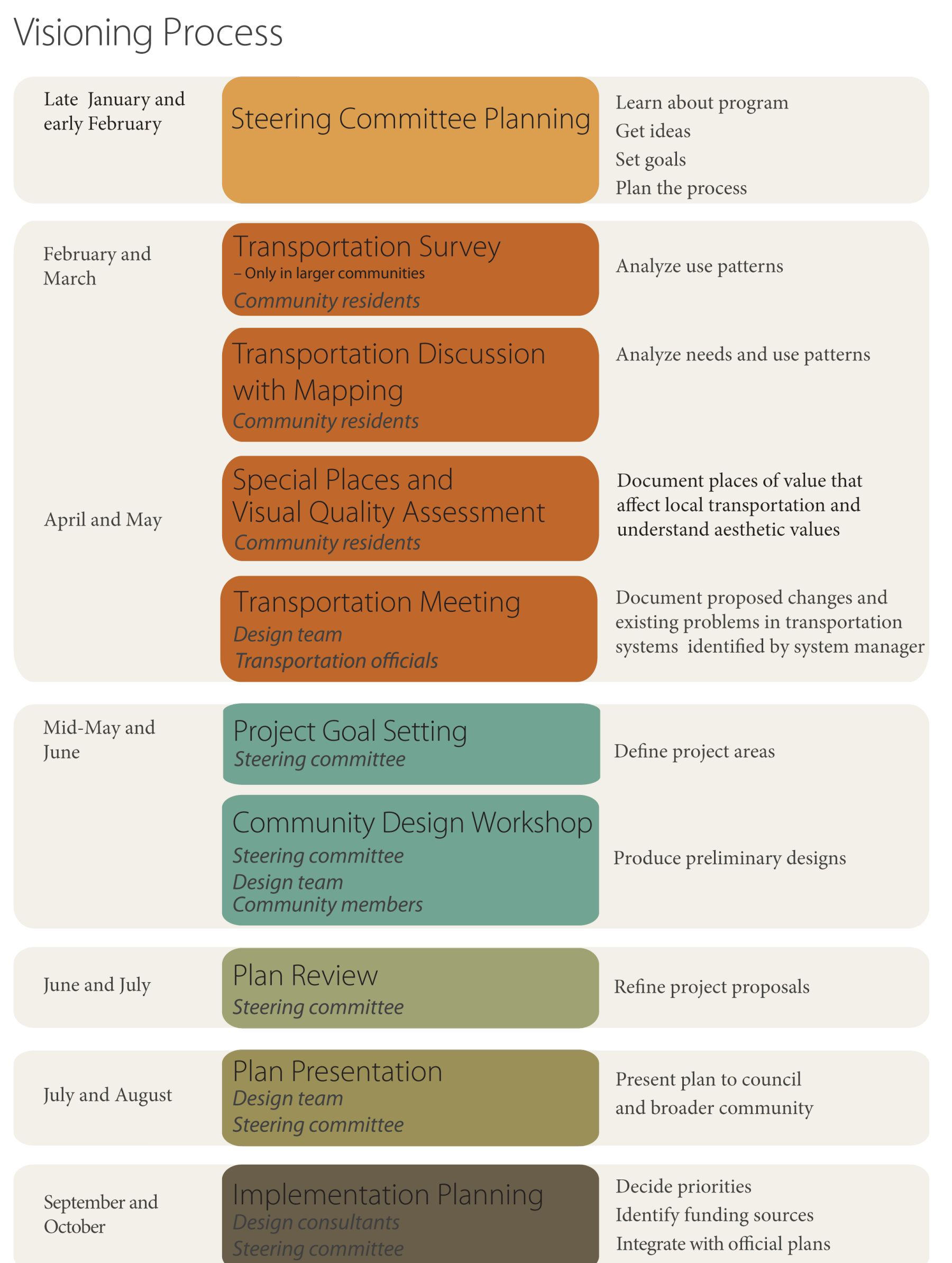
The Visioning Process
Visioning is series of individual activities that make up a complete
process. The process is divided into six different activities, some of
which consist of multiple tasks, that take place over the course of 10
meetings. The meetings are facilitated by a Trees Forever field
coordinator.
1. Steering Committee Planning
2. Community Assessments
3. Goal Setting/Design Workshop
4. Concept Plan Review
5. Concept Plan Presentation
6. Implementation Planning
The goals for each phase, the meeting sequence, and the products of each phase are illustrated in the
figure
at the bottom of the page.
During this planning phase, the facilitator organizes the community participants and clearly explains the planning process. Nominal group techniques are used to identify
problem areas or issues and desired outcomes.
The purpose of this activity is twofold: to understand the needs and
desires of residents and to engage them in the visioning process. The
steering committee recruits people to participate in a series of
assessment exercises, including an online survey (in communities with
populations of 1,500+), focus groups, special places mapping, and visual
quality assessment.
Online Survey
To better understand the needs and desires of the residents in
participating communities, the visioning program uses a random sample
survey consisting of questions directly related to transportation
issues. The survey is conducted only in communities with populations of
1,500 and higher.
Focus Groups with Mapping
The goal of the visioning program focus groups is to understand local
needs for sidewalk connections, recreational trails, streetscape and
entryway improvements, etc. They also help local committees understand
patterns of use and set priorities for improvement. Thus informed, the
visioning committee will be able to set goals that meet the needs of the
whole community.
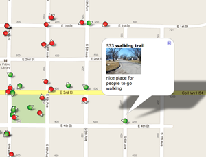
Special Places Mapping and Visual Quality Assessment
Because visioning is about changing the local landscape and
transportation network, it is essential to understand what places and
qualities are important to preserve and which should be enhanced. The
purpose of special places mapping and visual quality assessment is to
identify places and views that are valued by local residents. The
descriptions associated with these places and views are also useful in
understanding they are important.
Transportation Meeting
Knowledge of transportation systems in and around a community is
critical for sustainable transportation enhancement planning.
Transportation systems include paved and unpaved roadways, pedestrian
and bike trails, navigable waterways, railroad lines or rail beds from
abandoned railroad lines, and airports. The purpose of the
transportation meeting is twofold: (1) to engage local transportation
specialists and introduce them to the visioning process, and (2) to
determine whether any road construction projects or environmental or
legal constraints exist that may have an impact on the design process.
3. Goal Setting/Design
Workshop
Project Goal Setting
The purpose of this meeting is to set goals and to solicit visions for
the concept plan. The facilitator leads the discussion to emphasize
landscape areas to be addressed in the plan and to define goals
(performance standards) and visions for those areas. The design team is
on hand to answer questions and address technical issues that may arise.
Design Workshop
The purpose of the design workshop is to create a community concept plan
with participation of the local community. The landscape architect
directs the development of the concept plan, using the process mutually
agreed upon prior to the workshop day. At the conclusion of the meeting,
the design team leaves with materials generated during the workshop,
plus supporting materials as needed, to refine and develop the plan,
produce presentation boards, and write a feasibility study that provides
cost estimates and recommendations for each proposed enhancement.
Based on community input at the design workshop the design team develops a preliminary concept plan that is presented to the
steering committee.
5. Plan Presentation
Once the committee has
approved the plan, the design team makes final revisions and presents the concept plan to the community as a whole. The design team also prepares a feasibility report,
which summarizes the expected costs associated with proposed phased development. The concept plan is packages as a series of presentation boards which, along with the
feasibility study, are left with the community.
In this final phase the community committee determines strategies for achieving the vision developed with the design team in the community concept plan. The facilitator
works with the committee to determine what actions are required to achieve each phase of the plan and what methods should be used to measure progress. The facilitator
provides information about funding sources available and how to apply to these programs.
During this phase, the committee becomes the leader in involving the broader community volunteer group and for building support.
Download a PDF version of this chart.
Back
|
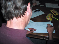
During meeting one, committee members are asked to draw a “landscape memory” and to complete the statement “My community world
be a better place if...”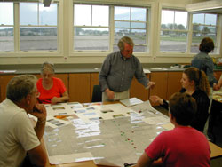
The committee
maps cultural, historical, natural,
and visual assessments, which are overlaid to determine relationships among the community’s resources.
Using GPS-enabled cameras, focus group participants are
able to digitally map the locations of transportation barriers and
assets in the community.
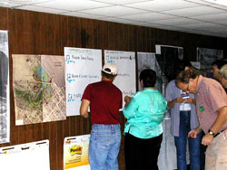
 During
special places mapping, residents identify important places in the local
landscape, which are recorded on a map. During
special places mapping, residents identify important places in the local
landscape, which are recorded on a map.
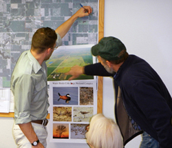
The committee members prioritize the goals
identified based on the needs assessment.
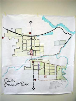
One product of the “charrette” is a preliminary community concept plan.
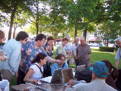
Community members give feedback to student
interns during the charrette.
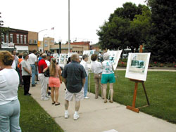
Community members view the final community
concept plan during the public meeting.
|